In 1938 the Ordnance Survey wrote to the Vicar (who would have been Rev. William Clark at this time) to ask permission to install a triangulation point on the roof of the church tower. Although permission is requested, the letter goes on to state that they have statutory authority to install their markers even if permission is not given.


© National Archives, Kew, their ref OS 69/19787
© National Archives, Kew, their ref OS 69/19787
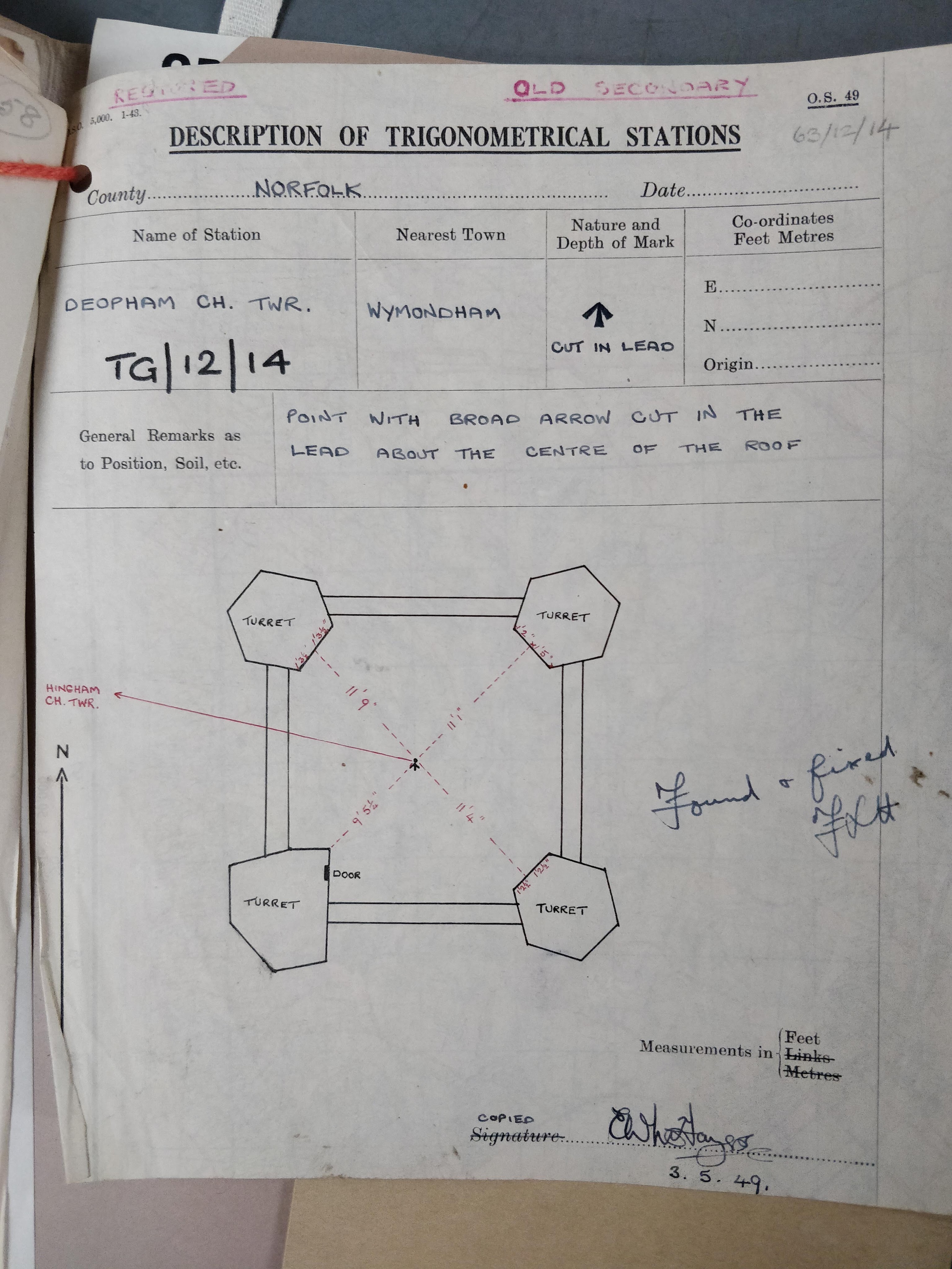
The following image shows Hingham church on the horizon in the distance; this was used to take bearings from the top of Deopham Church tower and from that to position other landmarks visible from this vantage point. The marking in the lead roof is no longer extant.
The building in the middle distance is Crown Farm.

Photo: G.P. Sankey, April 2023
The following image shows the Ordnance Survey marking at the foot of the tower to indicate that there is a triangulation point above:

Photo: G.P. Sankey, April 2023
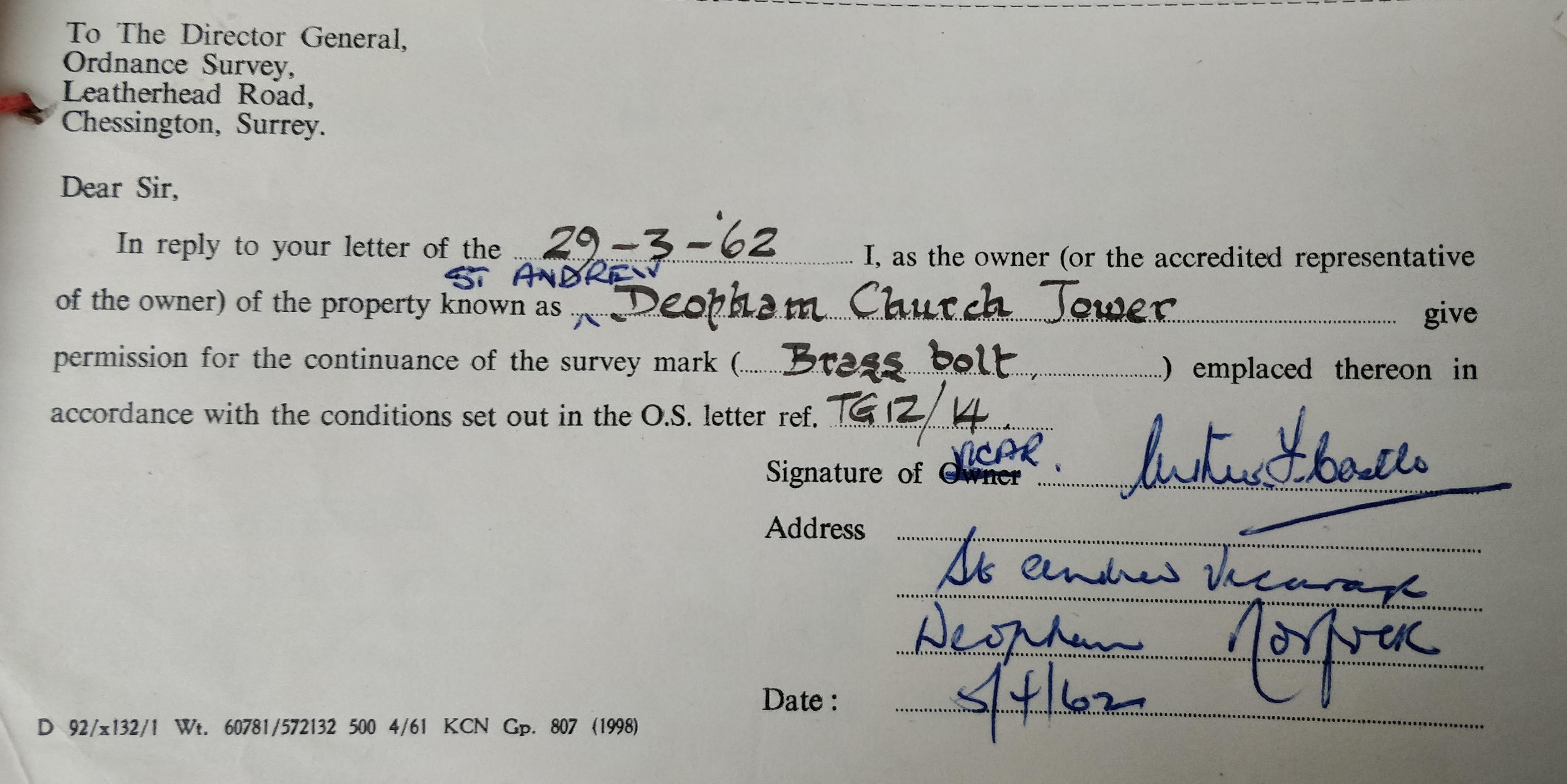
In 1962 the Rev. Arthur Castle, Vicar of Deopham church, authorised the retention of the triangulation point on the church tower:
Facts about Triangulation points
The following points about triangulation points or trig points are listed on the Ordnance Survey website:
- From every trig pillar, you should be able to see two others.
- Trig Pillars are sometimes referred to as ‘Hotine Pillars’.
- The trig pillar was first used in the retriangulation of Great Britain on 18 April 1936.
- 6,500+ trig pillars were built, but hundreds have been lost to housing developments, farming, coastal erosion, and other causes.
- Trig pillars were included on Bill Bryson’s list of favourite British items in his 2015 book ‘The Road to Little Dribbling.’
- Ben Nevis has the highest trig pillar; the lowest is Little Ouse, at -0.533m below sea level, in Cambridgeshire.
- The brass fitting on the top of a pillar is known as a ‘Spider’.
| Date | Change |
|---|---|
| 15/4/24 | O.S. comments about trig points |
| 19/6/23 | Published |
